


Rattlesnake Dance Trail: It’s the climb
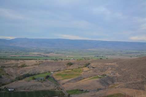
At the top of the trail hikers find scenic views of Ellensburg and its surroundings.
October 13, 2020
A mere 15 minutes outside of Ellensburg, the Rattlesnake Dance Trail trail offers a full view of the valley and a unique perspective, all while hiking about a mile each way.
Gear to Pack
A sturdy pair of tennis shoes and a water bottle are the only truly necessary gear for this hike. Parts of the trail, especially as you descend, can be tricky to get a solid footing due to loose rocks, so make sure to wear newer shoes with a solid grip. Even on an overcast or cloudy day, hiking this trail can be quite the energy drainer. So, be sure to pack extra water.
There is also a large enough area at the top of the trail to where you can hold a picnic, if hikers wish to pack extra food along with them.
The View
Regardless of which direction you look, there is a view when you get to the end of this hike. To the north you can see the entirety of Ellensburg with wind turbines looming behind and the Cascade Mountains even further in the distance. To the south, you can see the valley carved into the hills by the Yakima River. Allegedly, on a clear day you can see Mt. Rainer to the south, although on an overcast day this isn’t possible.
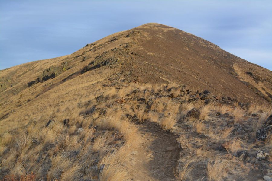
The Trail
The trail isn’t long, as the hike is only about a mile each way. However, overall, the trail is steep. There is a large elevation gain in a short distance. There are also sections of the trail that are ill-defined, and hikers are left to determine what the best path forward is, with several worn paths of the routes previous hikers have taken. There are also sections of the trail with large rocks, and at these points the trek is much closer to rock climbing rather than hiking.
The Terrain
The terrain is rocky and uneven, which is why a good pair of shoes will be helpful. There are portions of the trail where there is a large drop off on either side of the trail. Since the climb is so rapid and the cliffs are so steep, this offers the unique perspective of a seemingly birds eye view of the valley and the Yakima River below.
The area is also eerily quiet and peaceful. Since there is a lack of trees or any other large vegetation on the trail, hikers also get a view of the surroundings regardless of where they stop.
The Location
The trailhead is roughly 15 minutes away from campus by car and is extremely easy to get to. If you are in town, head south on Main Street, and continue down Canyon Road. The trailhead is a little nondescript, with only a small sign noting that you are in the right place. There is also a large gravel lot located at the base of the trail to park in. If you are driving from campus and you pass the Bighorn Campground, then you have gone too far.